
The Anthropogenic Aquifer
This project explores the hydrology of the land surface that has been intensively farmed, and the implications of this hydrology on future plant and animal communities. Historical application of sand, ditching, berming, and channel deepening all affect how surface and groundwater move through these areas. Thoroughly understanding the hydrologic function is the first step toward returning this land surface to tis former wetland condition. Piezometer measurements of water level in the bog and stream channels as well as stream flow and rainfall monitoring all contribute to this understanding.
Recent Updates
Team Hydro is tracking the water at Foothills
By
Christine Hatch
on June 13, 2022
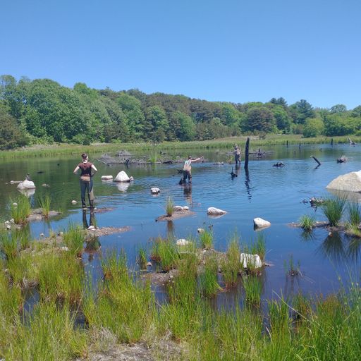
This past week, Christine led a field campaign to collect samples and data at Foothills Preserve. Our team included Lyn Watts, Emma Cady, Diana Holmes from UMass Amherst, as well as Francis Li from Smith College and Arianna Suarez from Williams College. We spent two days at Foothills Preserve measuring water levels, collecting water level and temperature data from data loggers, measuring stream discharge, installing seepage meters, and installing seepage meters. The water level in one of the ponds was lower than it was at the beginning of May, but there is still plenty of water on site!