Windswept Bog, Nantucket Island MA: Watershed-scale Wetland Restoration and Research
Towards a Design
The former cranberry farm at Windswept Bog was divided into fourteen discrete bog cells ranging in size from 0.7 to 8.4 acres. Each bog was separated by a 2- to 6-foot-high berm with water control structures built in to manage water levels for cranberry production. One of the relatively unique aspects of this site, as compared to many other cranberry bogs in the southeastern Massachusetts region, is that there is no channelized river or stream traversing the bog system. Instead, water flows across the site via diffuse, gravity fed flow paths.
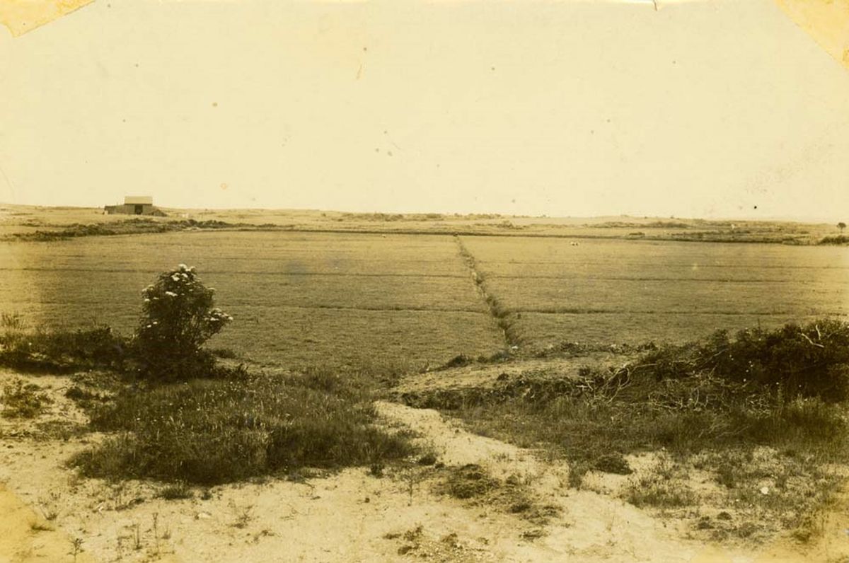
Windswept Bog c. 1918 (courtesy Nantucket Historical Association).
Similar to many other cranberry farms in the region, primary legacy impacts from past cranberry farming at Windswept Bog included: (1) a sand fill layer placed over native wetland soils, (2) lateral and perimeter ditching, berms, and water control structures, and (3) physical simplification including straight drainage channels and flat topography on the bog platform.
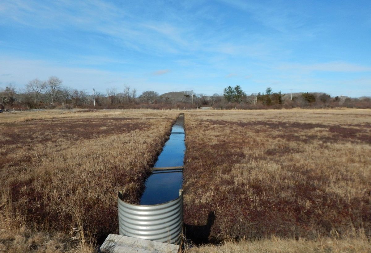
Windswept Bog, pre-restoration (2018).
The cumulative effect of these impacts was altered hydrology, dry soils in the upper bog platform, and a trajectory toward more upland plant species over time. In the absence of restoration interventions, the formers bogs would likely revert to upland habitats with an overall loss of beneficial wetland ecosystem functions such as water quality improvement, flood storage and fish and wildlife habitat.
The overall goals for this project included restoring wetland flow and connectivity, creating natural gradients between restored wetlands and surrounding uplands, maintaining or establishing valuable plant and wildlife habitats, perpetuating and enhancing public access, use and enjoyment of the Windswept Bog property, educating the public about the importance of restoration work, maintaining Stump Pond (a unique but human-made wetland created to serve as a reservoir for the cranberry operation back in the early 1900’s), and maximizing the restored wetland’s ability to filter excess nutrients to improve water quality in Polpis and Nantucket Harbors.
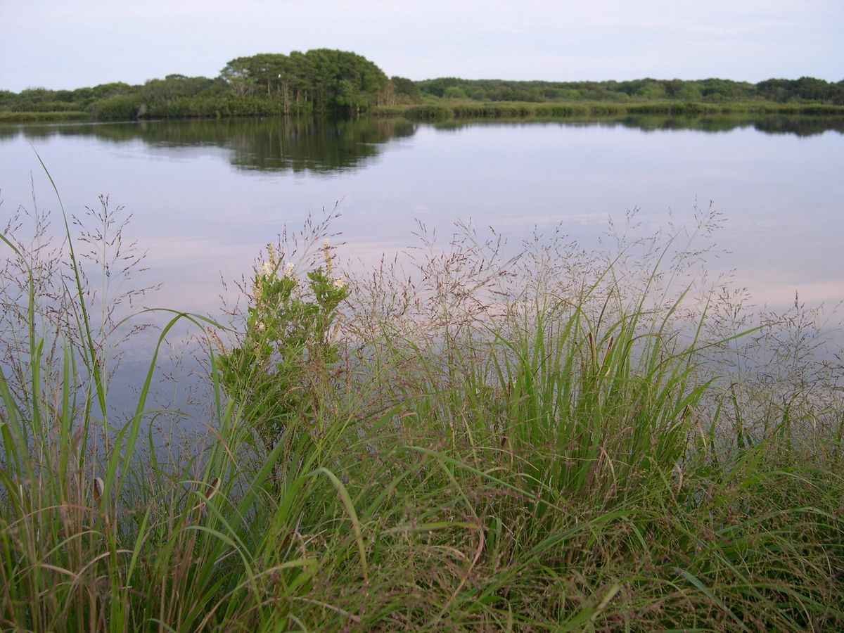
Stump Pond, the human-made wetland created to serve as a reservoir for the cranberry operation at Windswept Bog.
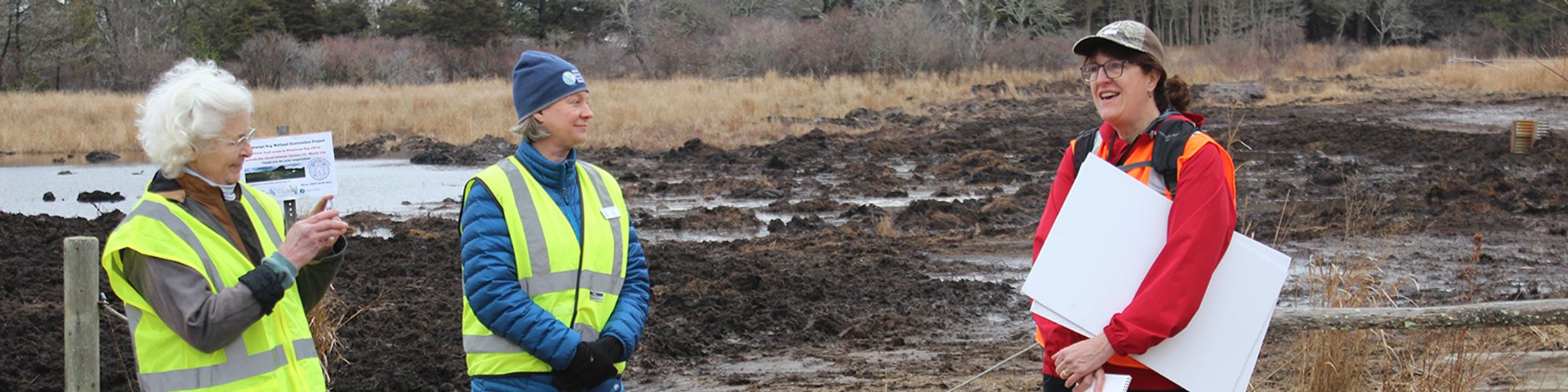
The Foundation’s Ecology Department staff have been collecting pre, during, and post-restoration site condition information since the early stages of this project. This includes capturing and tagging spotted turtles on the property and tracking their movement patterns via radio telemetry, monitoring water quality leaving the site, creating a comprehensive species list of plants on the property to document native, rare, unusual or invasive species, and conducting vegetation monitoring along transects and within plots to document plant community changes in the restored wetlands and adjacent uplands. Data loggers installed at numerous locations across the property document how surface water and groundwater flows through the site. Working with Mass. DER and Fuss & O'Neill (wetland engineers), all this information was incorporated into the project's restoration design plans to minimize environmental and rare species impacts to the greatest extent possible.
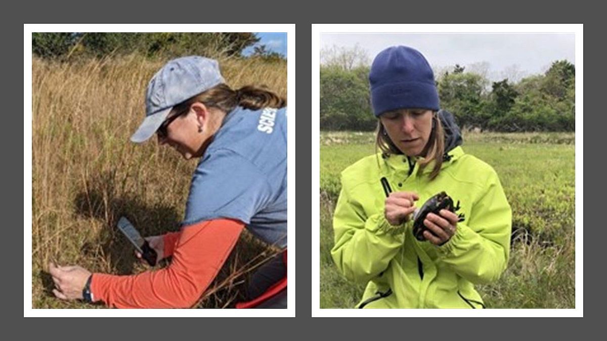
Kelly Omand (NCF Plant Research Ecologist/Botanist, left) and Danielle O'Dell (NCF Director of Research, right).
A key component of the design process was identifying and assessing natural wetlands across Nantucket that could serve as a model for the restoration work as well as a means of measuring project success. Staff from NCF's Ecology Department and Mass. DER teamed up to visit a number of potential “reference sites” on the island of comparable size, structure, and function to what Windswept Bog likely supported before it was altered by cranberry farming. A suitable reference site was located on property owned by the Nantucket Land Bank and Massachusetts Audubon Society that likely has similar soils, hydrology, glacial history, and other environmental conditions. This site, located approximately 0.7 miles southwest of Windswept Bog (41.28917167° N, -69.99517509° W), is a non-forested freshwater wetland approximately 10 acres in size and was selected as the best representative of a desired wetland types for Windswept Bog.
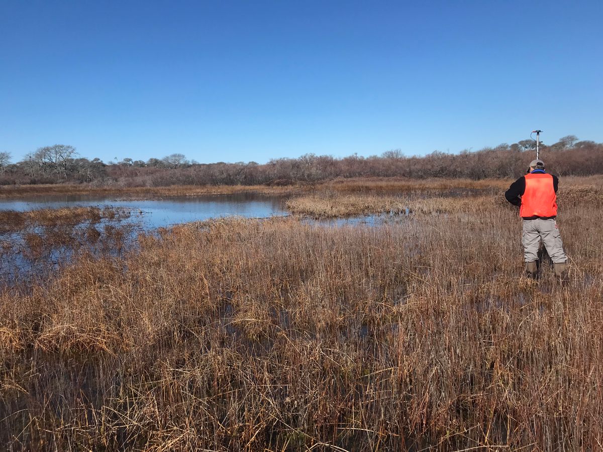
Survey work in the Windswept Bog Reference Site (41.28917167° N, -69.99517509° W).
Data collected at the reference site included: site photographs, a characterization of distinct plant communities along a transect between surrounding uplands, soil profile descriptions, and the collection of spot elevations (using RTK GPS) to better define the elevations of these communities with respect to the water table. Key findings to support the Windswept Bog’s restoration included:
- Topography/Morphology – The reference site is a broad, shallow depression surrounded by gently to moderately sloped uplands. There is less than 2.5-foot rise from the lowest elevations recorded in the wetland to the upland transitions (a distance of +/-100 feet). No stream channel is present in the wetland or allowing surface water enter/exit the wetland. Instead, surface water was observed flowing diffusely through the emergent vegetation. Overall, the ground surface within the wetland contains a variety of scales of microtopographic features, primarily hummocks-&-hollows with occasional pockets of deep marsh and shallow platforms with little or no surface saturation.
- Habitats – As expected, plant communities are organized by their elevation, which is to say their tolerance/preference for prolonged saturation. Low, inundated areas of the wetland are dominated by Sphagnum moss, swamp loosestrife, rushes and some cranberry. Larger hummocks and platforms support more woody species (leather leaf, sweet pepperbush, and steeplebush). Where transitioning to uplands, the higher edge of the wetland is mostly highbush blueberry with some sweet pepperbush.
- Soils – Augured pits between the shallow marsh and shrub swamp yielded organic horizons of at least 24 inches over a mixed horizon of highly decomposed organics and sorted sand (+/-12 in.). These horizons were underlain by more than 6 inches of a dark-gray sorted medium and coarse sands.
An additional component of the design process was gaining an understanding of groundwater elevation and how water flows across the Windswept site. Staff from Fuss & O'Neill and NCF installed water level data loggers (HOBO model U20L-04) throughout the site for continuous water level monitoring.
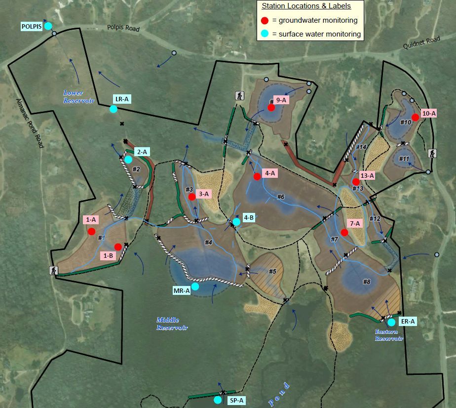
Locations of ground and surface water level loggers at Windswept Bog.
A total of 15 monitoring stations were installed at selected locations based on a cursory understanding of the site, including the following: 1) knowledge and experience of former and current cranberry bog operators, who actively managed surface flow and cranberry production until 2018; 2) habitat assessments and population studies conducted by NCF staff who documented important flora and fauna and the aquatic and wetland habitats supporting them; 3) ground-penetrating radar (GPR) surveys; 4) the site’s proximity and connection to Polpis Harbor and predicted sea level rise; and 5) elevation data derived from the dataset entitled Topobathymetric Model for the New England Region States of New York, Connecticut, Rhode Island, and Massachusetts, 1887 to 2016 (NOAA Office of Coastal Management, 2017).
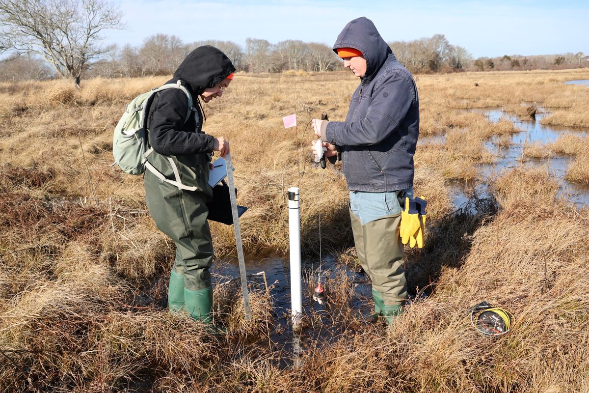
NCF Ecology Department staff Jisun Reiner (left) and Coleman Miller (right) checking and downloading data from a water level monitoring logger.
The data loggers were programmed to record the levels of surface or ground water roughly every 10 minutes and have run continuously since their installation, with the exception of being removed just prior to construction and replaced in the same locations just after construction was completed. Pre-restoration data collected at all stations is summarized in the March 18, 2022 Fuss & O'Neill Memo "Summary of existing hydrologic conditions, based on monitoring data from 7/7 through 12/14/2021; Windswept Cranberry Bogs; Polpis Road; Nantucket, Massachusetts."
All of this data was incorporated into the restoration design for Windswept Bog, which included the following key features:
- Complete or partial removal of most berms to allow natural surface flow across the site and to restore hydrologic connections between bogs and adjacent wetlands to the greatest extent possible.
- Removal of water control structures located between the retired cranberry bogs. During cranberry production, water control structures were used to precisely manage water for draining and irrigation purposes.
- Excavation in select areas of bog cells to lower the ground surface elevation and establish semi-permanent and seasonally flooded wetlands that support wetland and/or aquatic vegetation.
- “Roughening” the surface of selected sections of bog. For retired cranberry bogs, roughening is the physical action that breaks apart the existing mat of cranberry plants and the underlying sanded surface. The goal is to expose native seed bank and peat deposits, as well as create microtopography to improve habitat diversity.
- Modification of drainage ditches located between the retired cranberry bogs or water reservoirs. These artificial, incised channels were constructed to convey water between bogs and reservoirs for cranberry farming and are not representative of natural flow paths found on the island. Drainage ditches are being restored as diffuse, vegetated flow paths that mimic the natural surface flow conditions typical on Nantucket.
- Filling or plugging the lateral and perimeter ditches located within the retired cranberry bogs to create diffuse, vegetated flow paths.
- Construction of a new flow path between Stump Pond and the downstream bog on the eastern side of the property to replace the water control structures proposed for removal. A permanent spillway transition is being constructed to maintain an adequate water level in Stump Pond.
- Reconfiguration of the trail system and access roads to allow for continued public use and provide land management equipment and emergency vehicle access. Since portions of existing trails are currently located on berms that are being removed, the restoration design includes a revised trail system that seeks to maintain public access for passive recreational opportunities throughout the site. The revised layout includes crossing structures, such as bog bridges or boardwalks, constructed at key locations where berm sections are removed.