Windswept Bog, Nantucket Island MA: Watershed-scale Wetland Restoration and Research
Assessing Wetland and Upland Vegetation Communities
Active restoration of retired cranberry farms is important at sites such as Windswept Bog, which was established within a historic wetland that underwent drastic hydrology changes through cultivation. Decades of repeated sand deposition and compaction within the cultivated bogs changed the soil composition to one that retained much less water and was no longer habitable to many wetland plant species. As a result, the vegetational succession trajectory for retired cranberry bogs often leads to habitat dominated by upland, woody plant species, instead of reverting back into wetland. Thus, restoring Windswept Bog to natural wetland system to re-create and maintain important ecological functions was a high priority. The restoration work has created appropriate habitat for many wetland plant species and also maintained habitat for rare and protected species already present in both the former bogs and surrounding uplands.
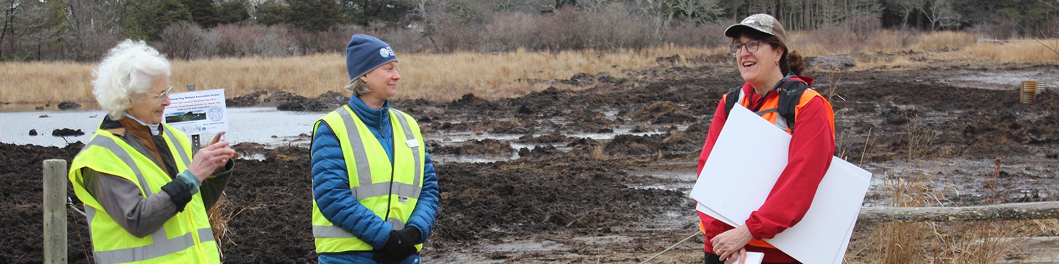
Prior to the initiation of wetland restoration work, NCF staff surveyed the entire site to document the presence of non-native, invasive plant species and implement management work. A number of potentially problematic species were detected and managed ahead of restoration construction work, which would involve extensive earth moving and soil disturbance. Species treated before restoration with follow-up monitoring and management to prevent re-establishment and spread include common reed (Phragmites australis), weeping lovegrass (Miscanthis sinensis), Japanese black pine (Pinus thunbergii) and black swallow-wort (Vincetoxicum nigrum).
To examine the vegetation community changes cause by wetland restoration activities, a robust vegetation monitoring protocol was developed and implemented at Windswept by NCF's Plant Ecology/Botany Program staff through consultation with experienced cranberry bog restorationists and through an examination of existing hydrology, soils and vegetation. Monitoring of vegetation pre-restoration was designed to capture the breadth of the entire proposed restoration area, including both wetlands and adjacent uplands. This monitoring, which involves multiple components described below, is now also documenting the successional pathway that the restored wetland is in the process of undergoing.
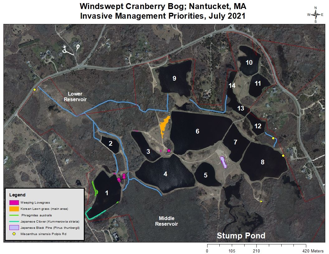
A total of 38 50-m transects were established across all bogs at Windswept, with two in each of the smaller bogs and four within larger bogs. Random start points for transects were established using ArcGIS within each bog, with a buffer of 10 ft. between each point. The start point was always designated as the western-most point in each transect, with transects running from SW to NE when possible, although this was not always possible due to the shape of some of the bogs. Moreover, while the start and end points were randomly created, transects were selected between points that would both encompass the area of the bog, while also not crossing the other transects.
Additional transects were established in bogs adjacent to upland areas where removed soil and sand was deposited during restoration. These transects ran perpendicular to outer ditches of bogs, and consist of 40 meters in the upland area and 10 meters into the bogs in order to capture changes in these plant communities over time. This sampling method provides a broad overview of species abundance and diversity and allows measurements of vegetation community changes pre and post-restoration.
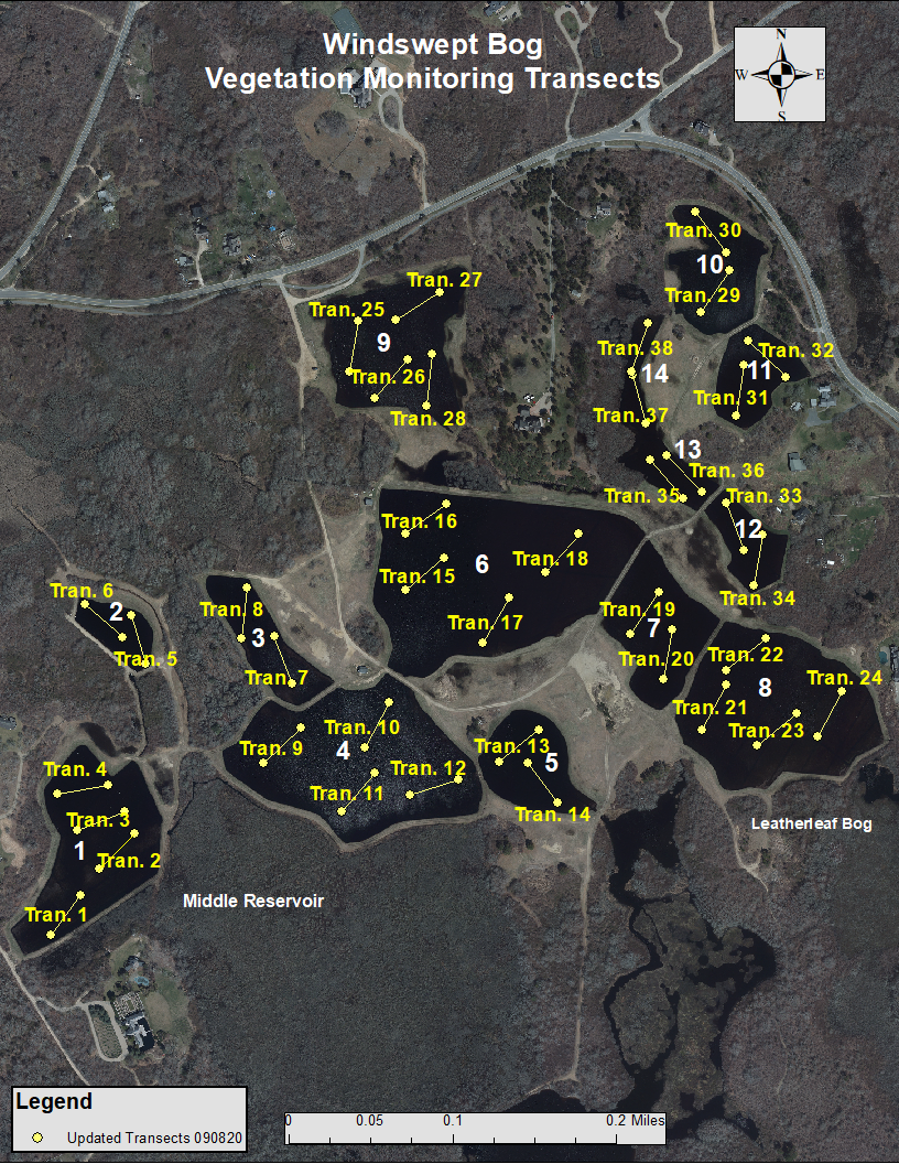
NCF Plant Ecology Field Assistant Ash Terry monitoring vegetation at Windswept Bog in September 2025.
Beginning in mid-September 2020 and annual since then, vegetation communities are measured along the transects using a line-point intercept method. Vegetation and ground cover type (e.g. litter, organic soil, mineral soil, sphagnum, open water) are sampled at every meter along the transect by placing a thin dowel directly adjacent to the transect tape, and touching the ground or water surface. Ground cover type is measured by recording the cover type that the end of the dowel is touching. More than one ground cover category can be recorded if the bottom of the dowel is touching more than one category. Any species touching the dowel above 0.5 meters is also recorded in a separate section for plants above 0.5 meters. Plants are identified to the species-level when confident, or to the genus level if not confident in species-level identification.
Two additional in-depth vegetation surveys are also conducted along each transect using 1 meter2 quadrats. The first quadrat is placed at a randomly generated meter along the transect, with the second quadrat placed 10 meters from the initial quadrat along the south side of the transect. Sampling within quadrats involves estimating the percent cover of total vegetation in major functional groups (graminoids, woody, forbs, dead woody, cryptogams, litter, organic soil, and mineral soil) and of each individual species in the plot. Percent cover is estimated using the following categories: < 1%, 1-2%, 2-5%, 5-10%, 10-25%, 25-50%, 50-75%, and 75-100%.
Photographs are taken at the start and end point of each transect, with the transect tape in in the center of the picture frame, at a height of 1.5 meters (chest height). Transect pictures include a dry-erase board with the transect number, start/end point, and date which is held in the right frame of photos. Two additional photographs (including a dry erase ID board) are taken of each quadrat: one overhead picture, at a height of 1.5 meters, and one side picture, standing one meter back from the edge of the quadrat that is perpendicular to the assigned meter, with the camera facing the plot at a height of 1.5 meters (chest height).
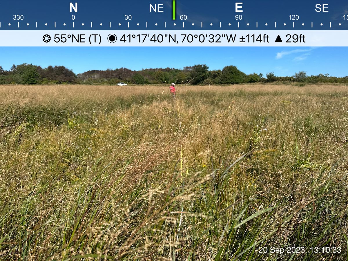
Bog 1, Transect 2 start prior to restoration (9/20/2023).
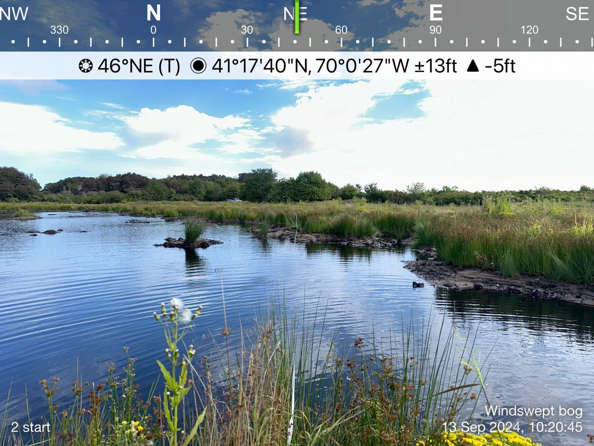
Bog 1, Transect 2 start post-restoration (9/13/20234).
Francesca LoPresti, Pat Ferrar and Chris Neill at Woodwell Climate Research Center have been working with Kelly Omand (NCF Plant Research Ecologist/Botanist) and other NCF scientists to compare methods for assessing the vegetation communities at Windswept Bog and additional former cranberry farm restoration sites across southeastern Massachusetts. Francesca LoPresti gave talk at 1:42:00 at the 2026 Sandplain Grassland Network Conference (link below) which compares the point intercept method (used by NCF) and plot based method (used by Woodwell). In summary, one point intercept transect identified an equivalent number of species to one 3m x 3m quadrat. The plot based method appears to be more practical for identifying species when high throughput monitoring is needed. Whereas the point intercept methods give a more accurate estimate of percent cover.
Comparison Point Intercepts Versus Quadrats for Quantifying Grassland-liken Vegetation. Francesca LoPresti, Research Assistant, ACES Fellow, Woodwell Climate Research Center, Falmouth, MA.
The Windswept Bog restoration established sandy upland deposition areas that were designed to intentionally create habitat for sandplain grassland associated species. This regionally-rare, early successional habitat type is predominantly restricted to coastal areas from Long island, NY through southern Maine, where salt spray, fire and other periodic disturbances are relatively common. In the first phase of the Windswept Bog project, a depositional area was created that was unsuccessful at recruiting target native species. This was because the excavated material contained higher than expected amounts of peat and clay, which provided nutrients and retained water, creating conditions that favored non-native, weedy grasses. In Phase 2, the plans for constructing the depositional areas were amended to include placing a cap of sand over the excavated cranberry bog materials. Early monitoring results suggests that the additional sand layer suppressed weeds and allowed recruitment of target sandplain species.
In the video below you can watch Kelly Omand's Talk at minute 1:12:00 of the 2026 Sandplain Grassland Network Conference reporting the results of this work.
Grasslands as Key Facets of Cranberry Bog Restorations: Windswept Bog Nantucket, MA. Kelly Omand, Plant Research Ecologist & Botanist, Nantucket Conservation Foundation, Nantucket, MA.
Note: Mattapoisett restoration also included creation of sandplain grassland habitat but did not require the additional sand cap to successfully establish these species. See Chris Neill's Talk at 1:26:00. To follow progress on this topic see the following insight posts What are the possible uses of excavated cranberry bed material? Minimizing the transport of excavated sand lowers construction costs.