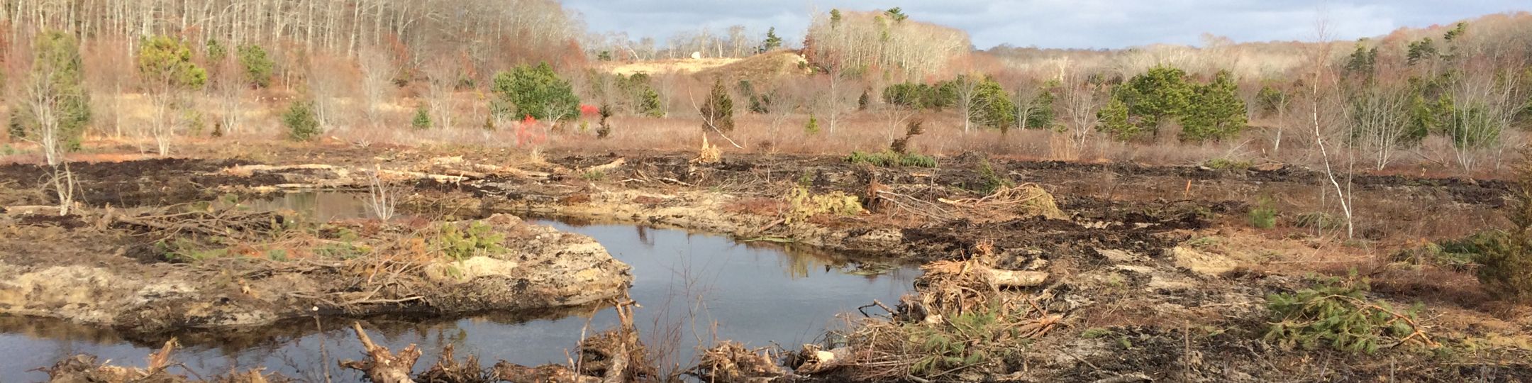
Tidmarsh Farms/Beaver Dam Brook wetland and river restoration project
Completed in 2016, the 225-acre Tidmarsh Farms/Beaver Dam Brook wetland and river restoration project in Plymouth, was the second wetland restoration of cranberry farmland in Massachusetts and, at the time, the largest wetland restoration in New England. At the time Tidmarsh Farms was 610 acre cranberry farm owned by the Schulman family and managed by Tidmarsh Farms Management. In 2010 the family placed a perpetual USDA Natural Resources Conservation Services (NRCS) conservation and wetland restoration easement on the eastern portion of the Farms and kick-started the restoration process. Target conditions for the project included a mosaic of wetland habitat types, free movement of fish from ocean to headwaters, and restored connectivity with surrounding forests, conditions to allow the site to evolve with climate change and sea level rise. The project became a Ma Fish and Wildlife Division of Ecological Restoration (DER) priority project in 2011. Funders included American Rivers, the Massachusetts Environmental Trust (MET), DER, NOAA, Living Observatory (LO), and DOI/USFWS with the award of a National Coastal Wetlands Conservation Grant. InterFluve,Inc developed the restoration design and engineering. SumCo Eco Contracting, Inc. implemented the design. Active restoration was completed in 2016. The site was acquired by the Massachusetts Audubon Society in 2017.
Living Observatory (LO), a non-profit collaborative, was founded in 2011 as the restoration took shape. The collaborative included individuals from the MIT Media Lab, MIT Sea Grant, Mt. Holyoke College, University of Massachusetts, the Division of Ecological Restoration, Environmental Protection Agency, InterFluve, SumCo, and many others. LO brought together a broad spectrum of individuals who were interested in furthering ecological research and monitoring of wetland restorations on retired cranberry farmland. This collaborative was instrumental in shaping the plan and process leading up to the wetland restoration LO members continue to monitor the restoration.
Tidmarsh Farms, the 610 acre cranberry farm in Plymouth Ma., was assembled by Evan Schulman in the 1980's. Located in the central portion of the Beaver Dam Brook watershed, the farm represents approximately 10% of the land area of this small coastal watershed (and 50% of the stream length). In 1989, the Farm produced 1% of Ocean Spray's cranberry fruit. However, in the 1990's changes in cranberry technology, development pressure, and climate related stressors were changing the business and In the early 2000's, the Schulman family made the decision to put Tidmarsh Farms into conservation and restoration. In 2010, Tidmarsh Farms placed approximately 200 acres of former cranberry bogs and swampland under a conservation and restoration easement with the USDA NRCS. In 2016, with the first phase of the wetland restoration completed, Tidmarsh became the second cranberry farm to be restored (the first being Eel River) and the largest flood plain and stream corridor restoration effort ever undertaken in Massachusetts. In 2017, the restoration site and surrounding uplands became the Mass Audubon Tidmarsh Wildlife Sanctuary. The Western portion of the Farms, located west of Beaver Dam Road, was acquired by the Town of Plymouth and became Foothills Preserve. The second phase of the wetland restoration \was completed in 2021 at Foothill Preserve and the Manomet Brook tributary.
Beaver Dam Brook is located in a small coastal watershed that has been highly impacted by a combination of residential, commercial and agricultural uses. Major modifications to the stream corridor occurred as a result of damming of the downstream portion of the Brook for textile operations and a grist mill from the early 1800’s through the turn of the last century. In 1923 the headwaters of the Brook were dammed to provide a reservoir capable of flooding the 140+ acres of cranberry bogs for harvest and frost protection during the winter. In the 1970’s, the northern-most extent of Beaver Dam Brook on the property was also channelized to provide more efficient outflow for water following the harvest and winter flood events. The goal of the current restoration effort is to transition the site from retired farm land to self-sustaining, high-quality, functional riverine and wetland habitat. As currently planned, the restoration will focus on alleviating anthropogenic stress to the natural site hydrology, including actions such as dam removals, stream channel re-naturalization, floodplain reconnection, bog surface roughening,and removing fill material from springs found on the site. Additional ecological processes such as the movement of sediment and organic matter will benefit from restored site hydrology, setting the stage for a restoration trajectory (and more dynamic conditions) that will continue into the future.
The watershed surrounding Tidmarsh Farms is host to a mix of commercial and residential uses. The State Route 3A corridor is the location of many of the shops, restaurants and businesses in the Village of Manomet. The White Horse Beach neighborhood, a densely built oceanfront community, surrounds Bartlett Pond at the terminus of the Brook. Additional residential development surrounds Fresh Pond in the eastern portion of the watershed. The western portion of the watershed is part of the open space buffering the Pilgrim Nuclear Power Station.
Beaver Dam Brook is a groundwater dominated system that receives approximately 90% of its water budget from groundwater input and 10% from surface water input. Groundwater inputs occur both at the headwaters and along the length of the stream. The groundwater contribution area for Beaver Dam Brook extends up gradient into Myles Standish State Forest, well beyond the boundaries of the watershed1. The entire watershed and the groundwater recharge area overlie the Plymouth Carver aquifer system. Plymouth Carver is a sole source aquifer that supplies the majority of the drinking water for the Town of Plymouth and surrounding communities2.
Tidmarsh Farms and the surrounding watershed are composed of glacial deposits that overlie Paleozoic crystalline bedrock. While the uplands are predominantly comprised of course sand, the wetland corridor hosts deep deposits of organic peat. The soil survey and a limited number of soil borings carried out by Horsley Witten indicate that the bog area is likely suitable for support of a perennial stream and associated wetlands1. Subsequent field investigations, including test pits and ground penetrating radar, have confirmed the presence of deep peat deposits on the site.
The environmental restoration project at Tidmarsh Farms was designed to make significant changes in ecosystem services provided by the site. For at least a century, food production had been among the most important services provided by Tidmarsh Farms. The decision to take the bogs out of production restore these areas to wetlands was designed generate a significant positive impact on overall ecological health of the region by strengthening the ecosystem services associated with a naturally functioning stream system, riparian forest and associated wetlands.
The landowners in conjunction with the restoration project team identified a primary and several secondary goals for the restoration:
o Primary and secondary Goals: Holistic, process-based river and wetland ecological restoration that focused on re-naturalizing site hydrology and kick-starting a bio-diverse wetland trajectory for the low-lying areas (former bogs).
o Improved stream habitat and connectivity designed for resident and diadromous fish passage, as well as increased channel and floodplain interactions;
o Improved wetland habitat was aimed at increasing biodiversity, productivity, and re-establishment of globally rare natural communities including Atlantic white cedar;
o Restored connectivity with surrounding forests.
o Species agnostic.
o Generating conditions for the ecosystem to become self-regulating, allowing for succession over time with limited or no future human maintenance.
Role of monitoring and Living Observatory: Living Observatory was founded to provide on-site environmental monitoring, data sharing (open access), outreach and learning around wetland restoration of cranberry farmland.
o LO monitoring embraced traditional ecological as well as nontraditional techniques. Traditional ecological monitoring included measurement of parameters such as precipitation, air temperature, water temperature, water quality, stream flow, and vegetation. Non traditional included streaming audio and video, virtual rendering of restored surfaces for game play, drone augmentation to measure soil moisture and other variables.
o Some of the monitoring data that is shared and used to inform larger regional studies about climate change
o Monitoring data was and continues to be served over the internet making it available to a broad audience.
o LO also supported on-site group visits and virtual education through the LivingObservatory.or web platform.
National Oceanic and Atmospheric Administration (NOAA), United States Fish and Wildlife Services (USFWS) National Coastal Wetlands Conservation Grant Program, United States Department of Agriculture Natural Resource Conservation Services (USDA NRCS), , Massachusetts Environmental Trust (MET), Massachusetts Department of Fish and Game Division of Ecological Restoration (DER), Town of Plymouth, American Rivers, Gulf of Maine Council on the Marine Environment, Massachusetts Audubon Society, Living Observatory, MIT Media Lab, MIT Sea Grant, Mt. Holyoke College, University of Massachusetts, and individual artists and donors.
Recent Updates
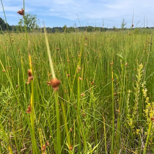
Three-squared bullrush