Living Observatory Field Guides
Watersheds from Aquifer to Ocean
The Plymouth-Carver Aquifer is a critical hydrogeological feature in southeastern Massachusetts, serving as a primary source of fresh water for a significant portion of the region. This extensive unconfined aquifer, approximately 199 square miles in area, underlies several towns, including Plymouth and Carver. It was formed roughly 16,000 years ago from highly permeable glacial outwash deposits, primarily sand and gravel, which allow for efficient infiltration and transmission of water.
Designated as a "Sole Source Aquifer" by the U.S. Environmental Protection Agency (EPA), it is recognized as the sole or principal source of drinking water for a large population, with no readily available alternative sources of sufficient quantity.
Its connection to the watershed that Mass Audubon Tidmarsh belongs to is an important piece to understanding water and its role through Plymouth’s history. Precipitation (rain and snowmelt) that falls on the land surface within the aquifer's recharge areas infiltrates the highly permeable sandy soils. This water becomes groundwater, which then flows slowly through the aquifer under the influence of gravity, moving from areas of higher hydraulic head to areas of lower head.
The aquifer directly contributes to the surface water bodies within the Tidmarsh watershed, including Beaver Dam Brook and Red Brook. Where the groundwater table intersects the land surface, particularly in depressions and low-lying areas, the aquifer discharges water, feeding springs, wetlands, ponds, and streams. These surface water features are essentially expressions of the underlying aquifer. Therefore, the quantity and quality of water in the Plymouth-Carver Aquifer are directly linked to the ecological health and hydrological function of the Tidmarsh landscape and the entire Red Brook watershed as it flows towards Cape Cod Bay.
Hey everyone! My name is Drip, and I'm not just any drop of water. I'm a super important, totally awesome, and a little bit adventurous drop of water who just had the most incredible journey through a place you might know: Mass Audubon Tidmarsh!
So, imagine this: One sunny morning, I was just chilling out in a tiny puddle on some moss at Tidmarsh. But before I even got there, I had a wild ride! My story actually started up in the sky. I used to be a tiny bit of water vapor, floating around with my cloud buddies. Then, plink! I condensed and fell as a raindrop, gently landing on the leaves of a tall tree at the highest points of the land around Tidmarsh. Or maybe I snowed down in the winter and slowly melted into the ground.
However I arrived, once I landed, I either soaked into the ground, becoming groundwater, or I clung to a leaf until I dripped off. This high ground, often called a "recharge area," is where the water begins its journey into the watershed. In this region, a lot of that water filters down into the enormous Plymouth-Carver Aquifer beneath us. It's like the starting line of a giant, underground water race! Some of us droplets even spend a while deep underground, slowly percolating through the soil and rocks, getting filtered and cleaned by the natural sandy layers, before bubbling up into a spring or seeping into a wetland. It's a slow, steady journey through this hidden water wonderland.
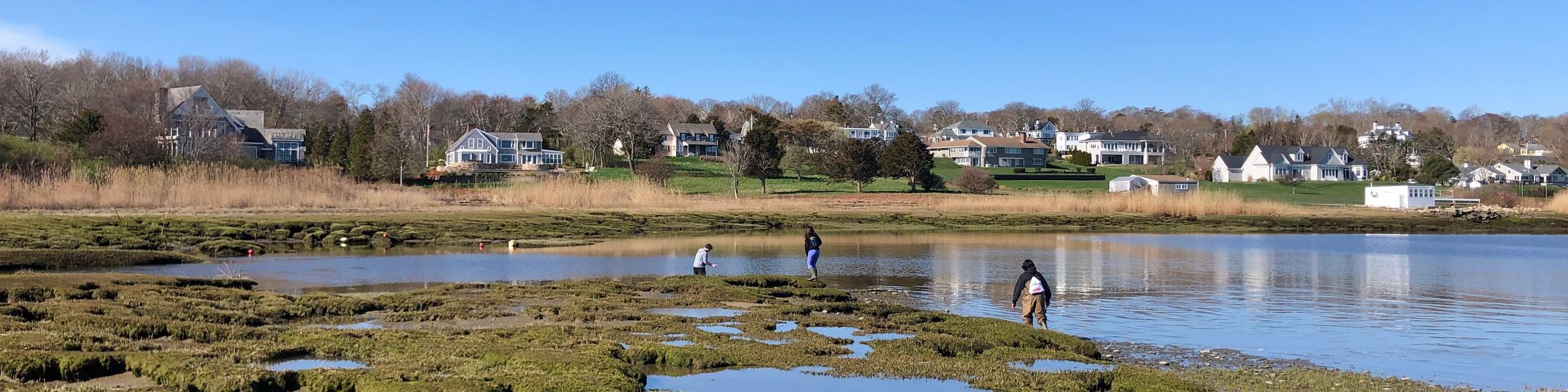
And that's how I found myself, after that underground adventure, in a tiny puddle on some moss at Tidmarsh. It was a pretty cool spot, with all sorts of dragonflies zooming around and birds singing. But I knew my destiny wasn't to just sit there and evaporate. Oh no, I was born to flow!
Suddenly, a tiny ripple. The ground slanted ever so slightly. "Whoa!" I thought, as I started to slide, joining a few of my droplet buddies. We were heading downhill, picking up speed as we flowed over some of the restored wetlands at Tidmarsh. This used to be a cranberry bog, but now it's super squishy and full of cool plants. We trickled over soft mud and past tall grasses, helping to water all the new plants that are growing there. It was like a giant, green water slide!
As more of my friends joined, we formed a tiny stream, gurgling and burbling. We squeezed between some cattails and then, whoosh! We tumbled over a small, rocky section. That's where the water gets a little faster, aerating itself and getting ready for the next part of the adventure. We were now officially part of the Beaver Dam Brook! Pretty cool name, right?
Beaver Dam Brook is like the main highway for water around here. We flowed under some wooden bridges that people use to walk around Tidmarsh, and I saw some kids pointing at us. "Look at the brook!" they exclaimed. I puffed out my chest, feeling pretty proud.
The brook then started to get wider and deeper. We passed by some areas that used to be old dikes from the cranberry bog days, but now they're all softened and natural-looking. The water here is super clear, and I could see tiny fish darting around. We were helping to keep their home clean and healthy!
As we continued our journey, Beaver Dam Brook snaked its way through more wooded areas. We flowed past big oak trees and tall pines, their roots dipping into the water, drinking us up. It was like a big hydration party for the forest! We were moving steadily, not too fast, not too slow.
Then, the exciting part! Beaver Dam Brook, our trusty highway, finally met its much bigger cousin: the Red Brook! This was a big moment. Red Brook is a pretty important brook, especially for all the fish, including the endangered sea-run brook trout. We joined forces with all the water from Red Brook, making an even bigger, stronger flow. It felt like we were all holding hands, millions of water droplets, all heading in the same direction.
From Red Brook, our journey got even more grand. The current picked up a bit, and I could feel the pull towards something much, much bigger. We flowed under Route 3A, a busy road, but we barely noticed. Our mission was clear: the ocean!
And then, I saw it! A glimmering, vast expanse of blue. The air started to smell salty, and I could hear the roar of waves. We were getting closer to Cape Cod Bay! Red Brook emptied directly into the bay, and as I tumbled out, I was greeted by the hugest body of water I had ever seen.
One moment I was a tiny drop that fell from the sky, filtered through the incredible Plymouth-Carver Aquifer, then became part of a puddle at Tidmarsh, and the next, I was swirling and mixing with the mighty ocean, becoming part of the vast, salty sea. It was an incredible journey, from a little patch of rewilded land to the immensity of the ocean.
So, next time you're at Tidmarsh, remember my story! Every single drop of water you see there, from the puddles to the brooks, is on its own grand adventure, all part of the amazing watershed that connects the land, the hidden aquifer, and the sea. And we all play a part in keeping it healthy and flowing! Thanks for listening to Drip's adventure!
Imagine you're standing on a hill, holding a glass of water. Now, pour that water onto the ground. Where does it go? Does it flow in a straight line forever? Nope! It's going to flow downhill, following the contours of the land, eventually joining other trickles of water, then small streams, then bigger rivers, and finally, probably ends up in a lake, an estuary, or the ocean.
That entire area of land where all the water — whether from rain, snowmelt, or even groundwater — drains to a common point, like a single stream, river, lake, or bay, is called a watershed!
Think of it like a giant bathtub, but instead of straight sides, the "rim" of the bathtub is made up of hills, ridges, and mountains. All the water that falls inside that rim will eventually flow to the lowest point.
Here's the breakdown:
- Boundaries: Watersheds are defined by topography – the high points of the land (like hills and ridges) that divide one drainage area from another. If you drop a raindrop on one side of a ridge, it flows into one watershed; drop it on the other side, and it goes into a different one!
- Interconnectedness: Everything within a watershed is connected. What happens upstream (higher up in the watershed) affects what happens downstream (lower down). If there's pollution introduced at the top, it can travel all the way down to the outlet. If forests are cut down upstream, it can lead to more erosion and flooding downstream.
- Water Cycle in Action: Watersheds are where we see the water cycle playing out right before our eyes. Precipitation falls, it infiltrates the ground (becoming groundwater), runs off the surface into streams, evaporates back into the atmosphere, and eventually, the cycle continues.
- Human Impact: Because watersheds are where we live, work, and play, our actions have a huge impact. Building roads, developing land, farming, and managing waste all affect the quality and quantity of water flowing through a watershed. That's why understanding your local watershed is so important for environmental protection!
You might hear watersheds also called "drainage basins" or "river basins." They come in all sizes, too! A tiny stream might have a small watershed, but many smaller watersheds can combine to form a much larger watershed, like the entire Mississippi River Basin.
To really visualize this, take a look at these diagrams:
Watersheds in Massachusetts:
- Massachusetts Watershed Map: This map from the Mass.gov website shows the major river basins (watersheds) across the state. You can see how the land is divided into these large drainage areas, with smaller local watersheds nested within them.
- https://www.mass.gov/doc/massachusetts-watersheds/download
- (If that specific direct download link changes, search for "Massachusetts Watershed Map mass.gov" on your favorite search engine)
- EPA MyWATERS Mapper: While not a static diagram, this interactive tool allows you to zoom in on specific areas in Massachusetts and see the local watersheds and stream networks. It's a great way to explore!
- https://www.epa.gov/waterdata/mywaters-mapper
Aquifers in Massachusetts:
- Massachusetts Aquifer Map (USGS/MassDEP): This map shows the major aquifers (areas of groundwater) in Massachusetts. You'll notice that these often underlie and interact with the surface watersheds. The Plymouth-Carver Aquifer, mentioned earlier, is one of these significant areas.
- While a direct, single, easily shareable image from the state isn't always available, you can find excellent detailed information and maps through the U.S. Geological Survey (USGS) and Massachusetts Department of Environmental Protection (MassDEP) websites. A good starting point for a visual understanding of surficial aquifers is usually in their water resources reports. Try searching for "Massachusetts surficial aquifer map usgs massdep" in a search engine. Look for maps that show the sand and gravel deposits.
- Groundwater and Surface Water Interaction Diagram (General): While not specific to MA, this type of diagram helps illustrate how groundwater (from aquifers) contributes to streams and wetlands, which are part of watersheds.
- A good example of such a diagram can be found by searching for "groundwater surface water interaction diagram" or "aquifer stream interaction diagram" in Google Images. Look for ones from educational or government sites like USGS or EPA.
By exploring these resources, you'll gain a much better understanding of how water moves across and beneath our landscapes, all thanks to the power of watersheds!