User's Guide
Data Objects
This page is a work in progress. More information is coming soon.
Additional information on the structure of the database and data formatting guidelines are currently available in the Files section of the Community Platform project page.
Object Types
An object’s type indicates what it represents, such as a restoration site or a soil monitoring plot. An object may have multiple types, so the same location could be both a soil plot and a vegetation plot.
Types define which metadata fields are valid for the object. If an object has multiple types, it will have the metadata fields for all of them. (See metadata).
Data
Data objects, as their name suggests, can store several types of data.
Geographic Data
Each data object should have a geographic representation. In many cases, this will be a single coordinate (latitude and longitude) measured by GPS or other surveying technique.
Other types of GIS shapes may also be used. A single point may suffice for a small sampling location, but an entire property is best represented by a polygon that shows its entire area. Another example might be a path representing a birding walk or a sampling transect.
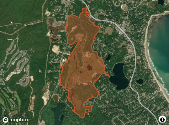
The geographic data is stored as GeoJSON, which can be edited and exported by many GIS software packages and online tools.
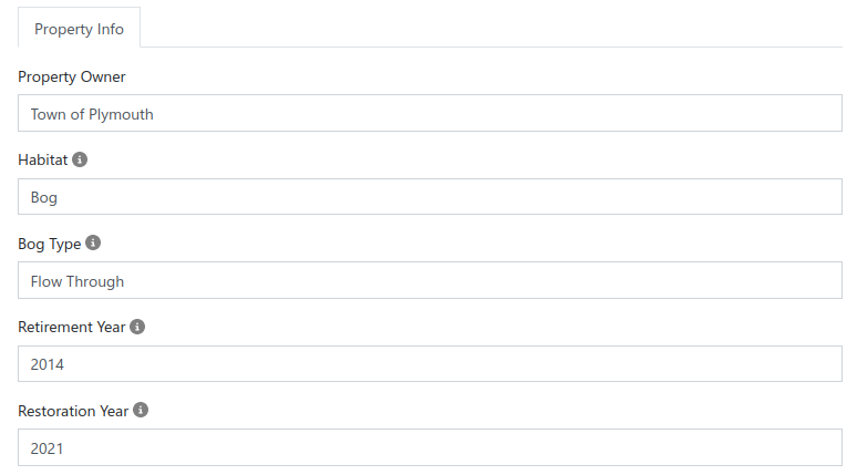
Metadata
Metadata are data that describe the object and provide context.
Sample Data
Samples are date (and optionally time) stamped observations recorded at the location represented by the data object. Samples are grouped into reports, which are collections of metrics recorded at the same time under an experimental protocol.