Living Observatory Summits
Views from the Summit
On May 22, 2026, Living Observatory hosted a one-day summit at the UMass Cranberry Station and via Zoom, focused on innovative wetland-restoration practices and ecological monitoring on retired cranberry farms.
In total, 40 people attended in person and eight participated online, representing:
- Land trusts/owners: Mass Audubon, Nantucket Conservation Foundation, Buzzards Bay Coalition, Barnstable Clean Water Coalition, Association to Preserve Cape Cod, and Cape Cod Cranberry Growers’ Association
- State and federal agencies: Massachusetts Division of Ecological Restoration, US Department of Agriculture, US Geological Survey, and US Environmental Protection Agency
- Research institutions: UMass Amherst, Boston University, University of Connecticut, MIT, Clark University, Mount Holyoke College, and Woodwell Climate Research Center.
- Engineering firms: Inter-Fluve, Fuss & O’Neill, and Horsley Witten Group.
Glorianna Davenport kicked off the summit by reflecting on the first decade of restoration projects and suggesting that we are in the beginning of Restoration 2.0, a new era in cranberry farm wetland restoration (click here to read more) and the sessions helped to color in that vision. The day’s three sessions explored this idea from different directions. Session 1 featured project teams reflecting on innovative practices at four sites, Upper Coonamessett, Cold Brook, Marks Cove, and Windswept. Session 2 considered how robust nitrogen monitoring can be scaled to inform design and measure performance across a growing number of projects. Session 3 brought participants into breakout groups to identify future needs for monitoring, stewardship, partnerships, and shared learning.
Across the presentations and discussions, six connected themes emerged that we think define Restoration 2.0 projects:
- Monitoring scaled to project goals
- Designing within connected and changing systems
- Making restoration tradeoffs explicit
- Using adaptive management during construction
- Planning for long-term stewardship
- Building partnerships, and shared knowledge
Below are highlights from each session that emphasize these emerging principles. To view the full schedule and talks from the day click here for the agenda. Quotes from the day are timestamped and correspond to the zoom recording, hosted on Vimeo (coming soon).
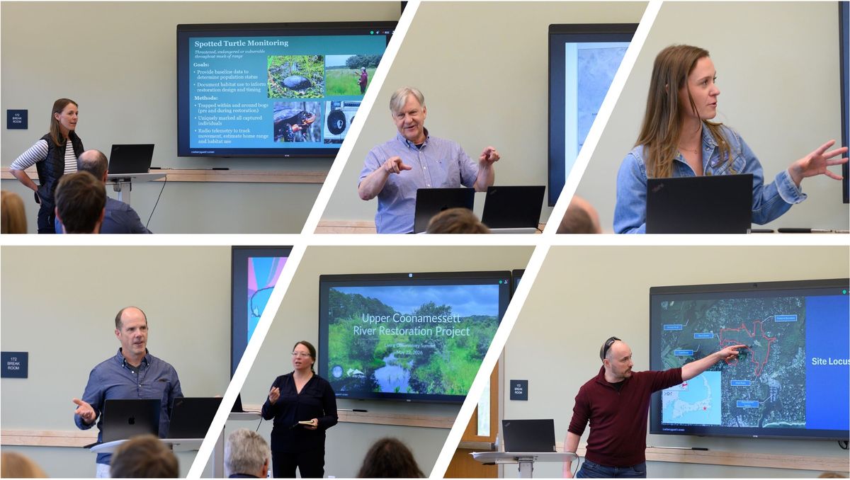
The goal of Session 1 was to examine how project teams are adapting restoration to site-specific conditions, and what monitoring is needed to learn from those decisions over time. In preparation, we asked teams from Upper Coonamessett, Cold Brook, Marks Cove, and Windswept to reflect on their project context, emerging practices in design and implementation, and the questions they hope monitoring will help answer as the sites develop. Each project had many unique aspects, but the following highlights stood out.
Upper Coonamessett
Andrea Judge of Inter-Fluve presented on the Upper Coonamessett and the many considerations for channel design. She described the challenge of restoring site while accommodating the water-management needs of an active cranberry grower downstream. The design had to absorb changing impoundment conditions from the cranberry farm operation.
“We can bring the growers to the table and have a wetland restoration in harmony with the growers.”
— Andrea Judge, 4:09–4:23
Cold Brook
Eric Ford of the Massachusetts Division of Ecological Restoration’s Cranberry Bog Restoration Program described design decisions at Cold Brook Eco Restoration. A primary goal of the project is nitrogen load reduction to Saquatucket Harbor the design also anticipates increasing tidal and salt influence over time in the lower sections. He mentioned how an early concept included more than ten acres of ponds intended to support denitrification. The team ultimately reduced the pond area in favor of emergent deep and shallow marsh, to meet goals for habitat-diversity.
“We originally had a lot of ponds… but that kind of violated our habitat diversity goals at the site. And so, we pulled back on that piece of it.”
— Eric Ford, 16:08–16:48
Marks Cove
Andrea Jerabek of Mass Audubon and Julianne (Julie) Busa and Michael Soares, formerly of Fuss & O’Neill, described Marks Cove as a restoration designed for sea-level rise and inland salt-marsh migration. Lower areas will receive minimal grading to enable the site to experience tidal influence sooner, while berm lowering and shallow topography will help higher areas retain freshwater for decades. A gradual transition zone will allow salt marsh to move inland over time.
“We want to set the system up for success, but we’re also not trying to fully control the end state.”
— Julianne Busa, 40:31–41:06
Andrea also described Mass Audubon work to develop a screening tool for wetland restoration candidates as part of the Making Space for Salt marsh migration initiative, which is in it self and innovative NOAA funded project that looks to build regional capacity through partnerships and strategic learning. Mass Audubon have identified 3000 acres of historic previously undocumented cranberry farms as part of their mapping efforts. The publicly available mapping tool will likely benefit the broader restoration and land conservation efforts.
Windswept
Danielle O'Dell and Karen Beattie of the Nantucket Conservation Foundation, together with Julie Busa and Michael Soares, presented on the restoration of Windswept. Pre-restoration plant inventories and turtle tracking influenced the timing and phasing of construction.
“We decided to take a phased approach in order to protect some of the real rare and unique things on the property.”
— Karen Beattie, 49:14–49:41
The team adjusted the designs to save some ditches with native plants to project distinctive habitats, and wildlife.
The project also demonstrated how field observations and good project team communication can lead to unexpected benefits. Michael Soares, described a recommendation from NCF Botanist Kelly Omad, who suggested they place organics excavated during construction were placed along a slope to reduce erosion. The material also helped spread volunteer seeds and create a habitat transition.
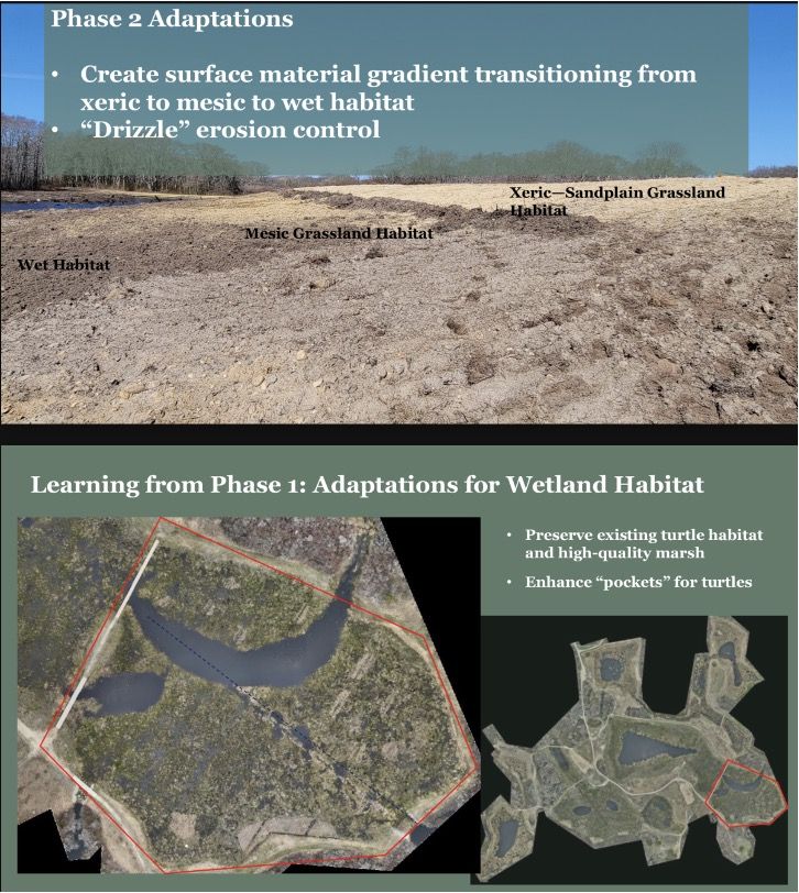
(from (slide (slides copied from Soares, Busa, Odell, Omad, Beattie, presentation on Windswept)
Nitrogen pollution is a critical stressor to coastal water quality on Cape Cod, where 87 percent of estuaries are now impaired (APCC 2023). Wetland restoration of cranberry bogs can help reduce nitrogen loads moving through watersheds and into coastal waters in the region (Wiegman et al. 2025). Monitoring restoration sites helps assess patterns of watershed loading and nitrogen removal, or assimilation, while informing future design and management decisions.
The goal of Session 2 was to contrast nitrogen-monitoring approaches at watershed, wetland and stream-reach, and groundwater scales. We asked Casey Kennedy, Sarah Klionsky, Tim McCobb, Neal Price, and Scott Horsley to explain how and why they monitored nitrogen, reflect on the strengths and limitations of their approaches, and identify the questions that remain. Collectively, the presentations offered a holistic perspective on how monitoring can be tailored to different goals, scales, and resources. A summary and some key lessons from the session are given below.
Casey Kennedy led off defined nitrogen load as the product of volumetric discharge (i.e. flow) and concentration. He noted that flow is largely a watershed process and may not change after hydrologic restoration, while concentrations of nitrate and total N are more responsive to management and vary seasonally, thus are important to monitor with field sampling. He reviewed practical, lower-cost options for measuring or estimating flow and found that biweekly to monthly nitrate sampling can support routine annual-load estimates. He also emphasized the importance of taking the watershed context when interpreting monitoring results. Citing rising nitrate concentrations over a decade of monitoring that were changing as a result of watershed development (rather than an unintended outcome of restoration).
[Kennedy Transcript: 01:34:00–01:49:00, link]
Sarah Klionsky identified groundwater seeps as hotspots for nitrogen removal. She suggested that longer groundwater residence time in the Coonamessett’s feeder ditches and wetland microtopography may help explain its higher nitrogen removal compared with the Childs River, where groundwater was routed more directly to maintain cold-water conditions. This points to a longstanding design tradeoff, one teams have confronted since Eel River, the first wetland restoration on a cranberry farm: increasing groundwater residence time can support nitrogen removal but can also raise stream temperatures (making the site less suitable for migratory cold-water species).
[Klionsky Transcript: 01:49:00–02:06:00, link]
Tim McCobb contrasted one-day reach-scale shapshot sampling of seepage runs (differential gauging), with continuous stream-gage and nitrate-sensor stations. Seepage runs can be used to efficiently identify high-loading groundwater inputs and critical source areas, McCobbs team assessed source areas in stream reaches across cape cod with this methods. Continuous monitoring can reveal seasonal and event-driven patterns but requires costly equipment, maintenance, and calibration, making it best suited to research or sentinel sites like Marston Mills, rather than broad deployment for routine monitoring. (McCobb, ~2:07–2:20)
[McCobb Transcript: 02:07:00–02:20:00, link]
Neal Price and Scott Horsley described the Comprehensive Study Area (CSA) at Marston Mills, a focused monitoring and treatment area at the upstream end of the greater cranberry-bog complex and future restoration site. The CSA is being used to map the sources and pathways of nitrogen-rich groundwater before testing several treatment approaches, including marsh systems, a permeable reactive barrier, and a pond. Rather than selecting one approach for the full restoration at the outset, the team will compare removal performance and construction cost across treatment systems, creating evidence to guide the larger project and future nitrogen-focused restorations.
[Neal Price, 02:25:00–02:33:00; Scott Horsley, 02:34:00–02:39:00]

Open floor
After lunch, participants given the opportunity introduce themselves and shared project updates. Architect, Jack Walthieu, presented a design for an interpretive archive museum at Tidmarsh. Patrick Farrar of Woodwell Climate Research Center identified a described his team's capabilities for vegetation monitoring, and identified need for monitoring five, eight, and ten or more years after restoration. Brian Wick of Massachusetts Cranberries encouraged the group to frame communications around restoration in ways that welcome active farmers as partners. Lyn Watts of UMass Amherst described how winter thermal imaging can reveal groundwater inputs, and Florencia Sangermano of Clark University called for reference sites that help teams interpret restoration outcomes within their landscape context.
Break out discussion
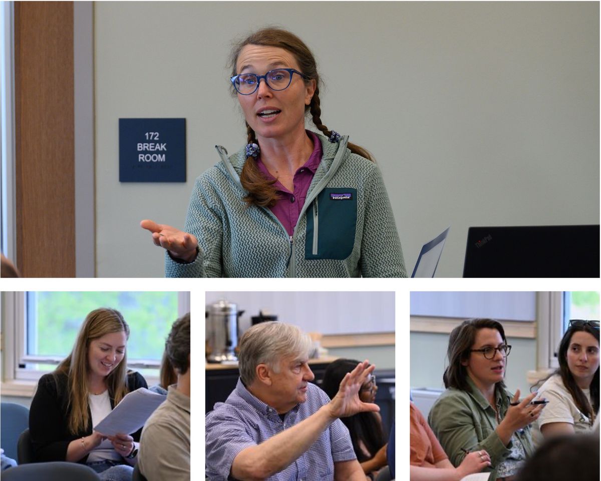
In the afternoon, Kate Ballantine led the group in breakout discussions focused on what monitoring has shown so far and how future monitoring could improve restoration outcomes. Participants organized in to several groups, after about 30 minutes the groups came back with the following guidance.
Recommendations:
- Make operations and maintenance plans standard project deliverables and establish durable approvals that allow adaptive stewardship after construction. (Group 1 [link])
- Design monitoring and treatment features around groundwater seeps and other important inputs. (Group 4 [link])
- Split monitoring responsibility by location, share monitoring methods, sampling locations, and standard operating procedures across projects.(Group 3 [link])
- Develop a searchable cross-site information system linking site conditions, treatments, vegetation, wildlife, and outcomes. (Breakout report-out [link])
- Clarify permitting pathways that enable growers to participate in restoration and modify agricultural infrastructure. (Christine Hatch, Brian Wick, [link])
- Strengthen long-term and comparative monitoring, including reference sites where appropriate. (Patrick Farrar and Florencia Sangermano [link])
Session 1 taught us that restoration must be designed within a working and changing landscape. Teams need to incorporate grower water-management needs and variable stream conditions (Upper Coonamessett), make explicit tradeoffs among goals such as nitrogen removal and habitat diversity (Cold Brook), and prepare for long-term landscape change such as salt-marsh migration (Marks Cove). Baseline inventories, wildlife tracking, and field observation can make projects more responsive and precise (Windswept). Regular, open communication helps teams recognize and act on these insights, reflecting a key tenet of ecological design: “everyone is a designer” (Van der Ryn and Cowan [link]).
Session 2 showed us how Nitrogen monitoring can be scaled to the key decision at hand. Routine sampling and low-cost flow estimates can track annual loads (Kennedy); reach-scale surveys can locate nitrogen hotspots (McCobb); and intensive stations and experimental treatment areas can reveal mechanisms and compare design options (McCobb; Price and Horsley). Across all approaches, results must be interpreted in watershed context and used to guide interventions where nitrogen-rich groundwater enters the system (Kennedy; Klionsky).
In the Session 3 breakout discussions, participants identified some critical needs to enhance practice: durable approvals for long-term stewardship, shared monitoring methods, clearer pathways for grower participation, and cross-site information systems that connect restoration treatments with ecological outcomes.
Together, the sessions pointed toward six connected principles for Restoration 2.0.
First, monitoring should be scaled to project goals, questions, and resources. Informal site walks and photographs can be valuable, while other questions require flow measurements, sampling, wells, or continuous sensors. The appropriate monitoring program should be determined by the decisions it needs to support.
“These systems are dynamic. They’re changing both in time and space, not just at the wetland, but in the watershed” -- Casey Kennedy (1:48:52–1:49:06).
Second, design for connected and changing systems. Active farming, wildlife, invasive species, urban development, and sea-level rise all influence the trajectory of a restored site. The wetlands restored through these projects are key components of a working landscape, supporting dependant ecological and economic functions.
Third, restoration teams should make tradeoffs explicit. Nitrogen removal, cold-water habitat, habitat diversity, salt-marsh migration, and/or other ecosystem services require different (sometimes conflicting) interventions. Naming these tensions and ranking priorities, allows stakeholders to make informed design choices and gives monitoring a clear purpose.
Fourth, management adaption begins during design and continues beyond construction. Monitor early and often, in whatever way you can, and share it however you can, with whomever you can. Baseline inventories, phased construction, field observation, and long-term monitoring allow teams to protect important features, respond to unexpected conditions, and adjust management over time. Maintaining a learning culture throughout.
Fifth, stewardship needs should be explicit in project permitting. Operations and maintenance plans, invasive-species management, rotational mowing, wildlife tracking, and continued observation can help sustain the intended trajectory of restoration. If these actions are not permitted, however, site maintenance can be hampered.
Sixth, meeting the demand for the next wave of projects will depend on expanding regional capacity. As growers renovate productive bogs with higher-yielding varieties and retire less productive beds, broader trends in cranberry agriculture suggest a net decline in production area. Newly available historic mapping from Mass Audubon has revealed additional restoration opportunities. Restoration can offer a green exit pathway for retiring farms and create high-value conservation opportunities for land trusts. Growers bring valuable knowledge, equipment, and landscape experience. Shared data systems can connect projects and make lessons more transferable.
In summary, the next stage of restoration will require appropriately scaled monitoring, diverse participation, plans and permissions for long-term stewardship, and systems for organizing, comparing, and acting on what monitoring reveals. The 2026 summit showed how a diversity of voices, including growers, landowners, scientists, engineers, conservation practitioners, and community partners, can lead to more sensitive, site-responsive restoration. Monitoring data also becomes more valuable when it can be compared across projects. Living Observatory’s platform, including project webs, photo-monitoring tools, and the Insight capture tool, can help preserve observations, bring diverse perspectives into conversation, and make them available to future project teams.
Author
